Search Term Record
Metadata
Search Term |
Red Mountain Railway |
Number of Object records |
0 |
Number of Archive records |
47 |
Related Records
-
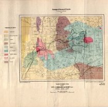
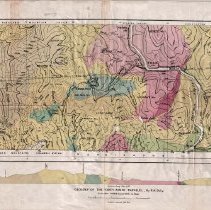
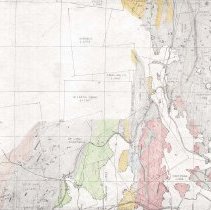
A1996.34.1 - Map
Geological map of the Rossland area produced by the Geological Survey of Canada in 1906.
Record Type: Archive
-
A2020.000 - Collection
Large format maps and drawings from 1890s to the 1990s. The Collection contains the following themes Mining, Surveys, Rossland City Maps, Rossland Railways, Fire Insurence, Miners' Union Hall, Building Plans, and Provincial/National Maps.
Record Type: Archive
-
-
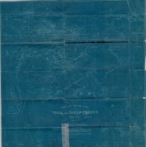
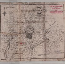
A2020.000.115 - Map
Hislop's Mining Map of Trail and Sheep Creeks - The Great Gold Camp of Southern West Kootenay British Columbia.
Record Type: Archive
-
-
-
-
-
-
-
-
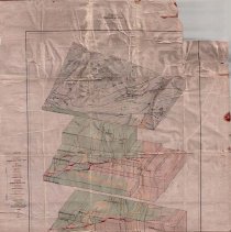
A2020.000.208 - Drawing, Technical
Stereograms of a Block of Ore - Bearing Country Rossland, B.C. produced by Canada Department of Mines - 1915.
Record Type: Archive
-
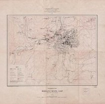
A2020.000.209 - Map
Topographical Sheet Rossland Mining Camp British Columbia produced by Canada Department of Mines - 1906.
Record Type: Archive
-
A2020.000.228 - Map
Map showing the Spokane Falls & Northern Railway in a portion of upper Rossland.
Record Type: Archive
-
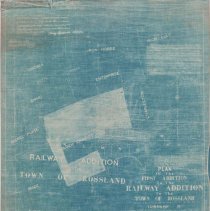
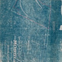
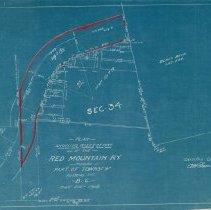
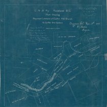
A2020.000.229 - Plan
Plan Showing Right of Way of the Red Mountain RY Through Part of Rossland.
Record Type: Archive
-
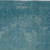
A2020.000.234 - Plan
Blueprint plan showing the placement of Columbia & Western Railway and a proposed extension between the Centre Star and Le Roi Mines.
Record Type: Archive
-
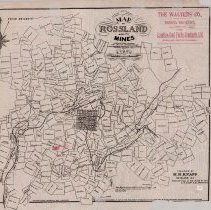
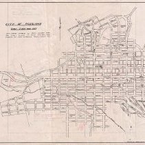
A2020.000.248 - Map
Map of the City of Rossland, with handwritten mining claims and places of note.
Record Type: Archive
-
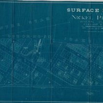
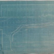
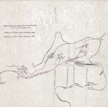
A2020.000.261 - Plan, Site
Railway Trackage within the City Boundaries City of Rossland, B.C.
Record Type: Archive
-
-
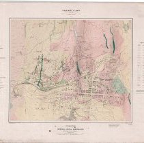
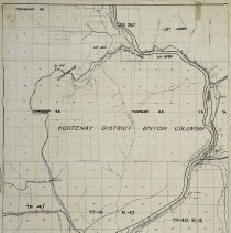
A2020.000.291 - Map
Special Map of Rossland, British Columbia produced by Department of Mines Geological Survey Branch - 1909.
Record Type: Archive