Search Term Record
Metadata
Search Term |
Nickel Plate Mine |
Number of Object records |
1 |
Number of Archive records |
26 |
Related Records
-
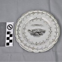
2008.43.1 - Plate, Commemorative
Souvenir plate showing the War Eagle, Centre Star, and Nickel Plate mines.
Record Type: Object
-
-
-
-
A2020.000.208 - Drawing, Technical
Stereograms of a Block of Ore - Bearing Country Rossland, B.C. produced by Canada Department of Mines - 1915.
Record Type: Archive
-
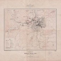
A2020.000.209 - Map
Topographical Sheet Rossland Mining Camp British Columbia produced by Canada Department of Mines - 1906.
Record Type: Archive
-
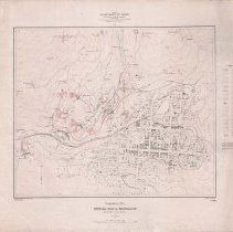
A2020.000.213 - Map
Topographical Sheet Special Map of Rossland British Columbia produced by Canada Department of Mines Geological Survey Branch - 1908.
Record Type: Archive
-
-
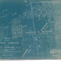
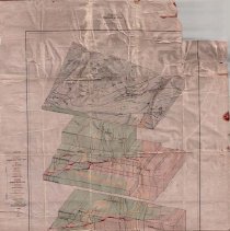
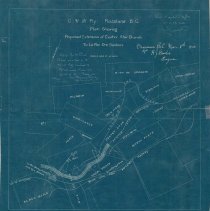
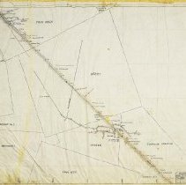
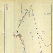
A2020.000.234 - Plan
Blueprint plan showing the placement of Columbia & Western Railway and a proposed extension between the Centre Star and Le Roi Mines.
Record Type: Archive
-
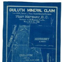
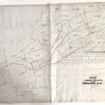
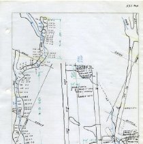
A2020.000.24 - Map
Small mining claim map featuring the Duluth, Superior, Noonday, and Golden Dawn claims. There is a key map of Rossland with mining claims at the bottom.
Record Type: Archive
-
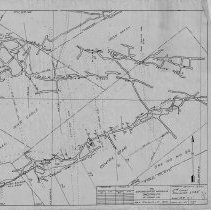
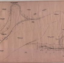
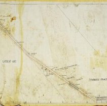
A2020.000.261 - Plan, Site
Railway Trackage within the City Boundaries City of Rossland, B.C.
Record Type: Archive
-
-
-
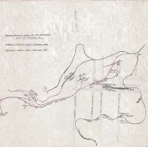
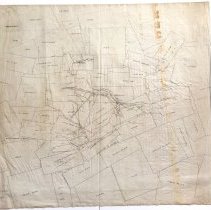
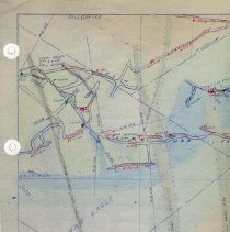
A2020.000.330 - Map
A map that shows various railways and land lots in and around Rossland B.C.
Record Type: Archive
-
-
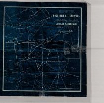
A2020.000.39 - Map
Mining claim map featuring the Fool Hen & Treadwell Mineral Claims and the Jubliee & Bingham Fractions.
Record Type: Archive
-
A2020.000.510 - Plan
Binder of 24 mine level maps and 25 accompanying assay sheets detailing the 2nd level of the Centre Star Mine.
Record Type: Archive
-
A2020.000.511 - Map
Binder of 22 mine level maps and 24 accompanying assay sheets detailing the 3rd level of the Centre Star Mine.
Record Type: Archive
-
A2020.000.513 - Map
Binder of 24 mine level maps, 36 accompanying assay sheets and 8 loose-leaf sheets pertaining to the Le Roi Mine 100 and 200 levels.
Record Type: Archive
-
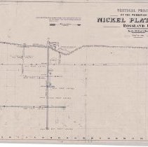
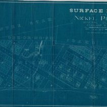
A2020.000.56 - Drawing, Technical
Vertical projection of the Nickel Plate Mine - 1901.
Record Type: Archive