Search Term Record
Metadata
Search Term |
Rossland Drill Hall |
Number of Object records |
0 |
Number of Archive records |
1 |
Related Records
-
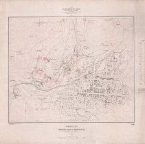
A2020.000.213 - Map
Topographical Sheet Special Map of Rossland British Columbia produced by Canada Department of Mines Geological Survey Branch - 1908.
Record Type: Archive
-
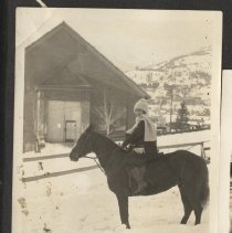
A2022.016.088 - Photograph, Black-and-White
Black and white photograph of Grace Wadds sitting on a horse outside of the Rossland Drill Hall in the winter, circa 1920s.
Record Type: Photo
-
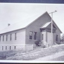
A2023.000.010.1036 - Transparency, Slide
Slide of a black and white photograph of the Rossland Drill Hall on a black background photographed on a red, floral-patterned carpet, date unknown. The original photograph dates from circa 1910.
Record Type: Photo
-
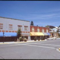
A2023.000.010.847 - Transparency, Slide
Slide of the north side of Columbia Avenue looking east from the Queen Street intersection, June 1987.
Record Type: Photo