Search Term Record
Metadata
Search Term |
Record Ridge |
Number of Object records |
0 |
Number of Archive records |
3 |
Related Records
-
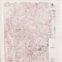
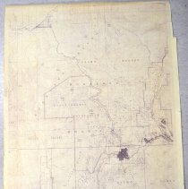
A2020.000.212 - Map
Topographical map of the Rossland—Trail area (west) produced by British Columbia Department of Land and Forests - 1951.
Record Type: Archive
-
-
A2021.018.038 - Photograph, Color
Colour photograph of Lower Rossland looking up to Mount Roberts during the winter, January 1965. Part of the George Coop Fonds.
Record Type: Photo
-
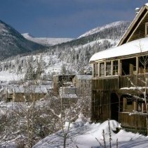
A2021.018.039 - Photograph, Color
Colour photograph of Miss Martin’s house in Lower Rossland during the winter with Mount Roberts and Record Ridge in the background, January 1965. Part of the George Coop Fonds.
Record Type: Photo
-
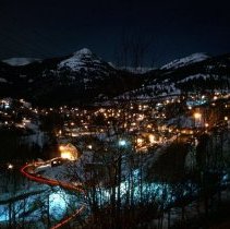
A2021.018.055 - Photograph, Color
Colour photograph Lower Rossland captured at night in the winter, March 1967. Part of the George Coop Fonds.
Record Type: Photo
-
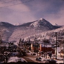
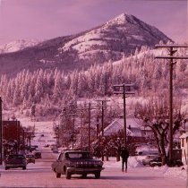
A2025.000.005.017 - Transparency, Slide
Slide of a Rossland street looking west in the winter with Mountain Roberts in the background, circa 1969.
Record Type: Photo
-
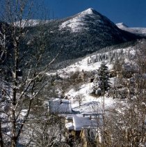
A2025.000.005.018 - Transparency, Slide
Slide of Columbia Avenue, looking west from near Monte Cristo Street during the winter with Mount Roberts in the background, circa 1970s.
Record Type: Photo