Search Term Record
Metadata
Search Term |
Nelson & Fort Sheppard Railway |
Number of Object records |
0 |
Number of Archive records |
10 |
Related Records
-
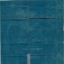
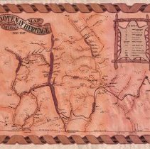
A2020.000.115 - Map
Hislop's Mining Map of Trail and Sheep Creeks - The Great Gold Camp of Southern West Kootenay British Columbia.
Record Type: Archive
-
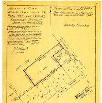
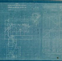
A2020.000.183 - Plan, Site
Site plan of Lot 39 (Columbia and Kootenay Aves in Rossland).
Record Type: Archive
-
-
-
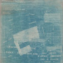
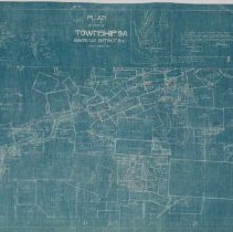
A2020.000.207 - Plan, Site
Plan of the Nelson & Fort Sheppard Land Grant in Rossland.
Record Type: Archive
-
-
-
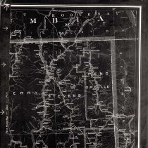
A2020.000.344 - Map
Map showing the Columbia & Western Railway's right of way in part of Rossland.
Record Type: Archive

-
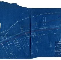
A2020.000.35 - Map
Small blueprint map featuring the Nelson and Fort Sheppard Railway station, tracks, and power lines in Waneta.
Record Type: Archive