Archive Record
Images
Metadata
Catalog Number |
A2020.000.210 |
Object Name |
Map |
Tagline |
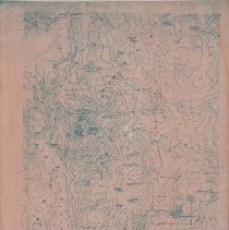
Topographical map of the Rossland-Trail area. |
Collection |
MS 84 - Map & Plan Collection |
Scope & Content |
Topographical map of the Rossland-Trail area. Rossland, Warfield, and the Canada-US border area marked on the map. There is a large arching title on the left side of the map denoting it as the Rossland Range. All of the major mountains/ridges and rivers of the areas are represented. The elevations are given with the contour lines. Some features of note include: OK Mountain, Old Glory Mountain, Tamarac Mountain, Grouse Ridge, Mount Sophia, Ivanhoe Ridge, Mount Kirkup, Grey Mountain, Esling Creek, Lamb Creek, Crowe Mountain, Mount Mackie, Neptune Mountain, and Goat Mountain. |
Date |
1947/ / |
Size |
35.5 x 52.5 |
No. of sheets |
1 |
Medium |
Paper |
Search Terms |
Ivanhoe Ridge Old Glory Mountain Warfield, BC Record Mountain Granite Mountain Rossland, BC Goat Mountain OK Mountain Rossland Range Grey Mountain Grouse Ridge |
Subjects |
Topography Mountain Mountain Range |